Mounts Ritter and Banner are the king and queen of the Ritter Range in the Ansel Adams Wilderness just east of Yosemite. John Muir had his closest brush with a "clean mountain death" on the north face of Ritter in 1872. I climbed Banner in 1984 while hiking sections of the John Muir Trail and had my own scare on a rainy descent back to camp.
Thirty-two years later, in late September 2016, I found myself again at 11,150-foot-high North Glacier Pass looking down on Lake Catherine and the Ritter-Banner Glacier that lingers still above the lake. Both Muir and I climbed this glacier to its top to ascend our respective peaks--Muir heading south up Ritter and I north up Banner.
In this photo essay, I interweave my 1984 photos with my 2016 images to show how the glaciers have retreated. I was thirty-five for my 1984 solo backpack and sixty-seven for my 2016 hike--which I took with my long-time climbing friend, David Witt, from Taos, New Mexico.
 |
| Banner from Thousand Island Lake, August 1984 |
 |
| Banner reflection in Thousand Island Lake, September 2016 (note diminished glaciers and snowfields) |
 |
| My solo 1984 Thousand Island Lake camp with peace flag on pack and rainbow over Garnet Pass |
 |
| Our 2016 Thousand Island camp |
 |
| My 1984 shadow at the beginning of the climb past Mt. Davis |
 |
| Billberry was scarlet in the morning backlight on the way up to the pass in 2016 |
 |
| David heads towards North Glacier Pass, 1,300 feet above our camp (Banner on left and Mt. Davis on right) |
 |
| At this snowfield we still could not see the pass. We were aware of the rockfall danger here so kept moving. |
 |
We make the pass and find it almost impossible to stand in the strong gusts
|
 |
| 2016 view of Ritter-Banner Glacier. The glacier has retreated at both top and bottom when compared with the 1984 view below |
 |
| 1984 view shows a robust glacier spawning bergs into frigid Lake Catherine |
 |
| In 1984, my climbing partner, Don Stark, and I made a perilous traverse from the pass over to the glacier. We wanted to see how far we could get. Neither of us had crampons and I had no ice axe to arrest a slide. |
 |
| We make it to the base of the glacier . . . |
 |
. . . and then to the head of the 1,000-foot-high glacier with an intimidating view of our way down . . .
|
 |
| . . . and begin the 1,000-foot talus ascent of Banner despite a complete whiteout (oh, the folly of youth!) |
 |
| Looking down at the head of the glacier (in 1873 Muir headed down to the left) |
 |
Nearing the summit of Banner
|
 |
| Don on Banner's summit block, which looked like an asteroid suspended in space. No view that day! We made it back to our camp but not before I had a fall on rain-slickened rocks that caused a head concussion, that luckily turned out to be minor. |
 |
| Forward to the future thirty-two years and I'm with David at North Glacier Pass discussing our options at this windy and cold spot. I'm on a mission to find the spot where Muir made his sketch "One of the highest Mount Ritter fountains." Note: This is the view of the Ritter-Banner Glacier from the outlet of Lake Catherine. The retreat off the north (sunnier) side of the glacier since my 1984 visit is striking. |
 |
| Muir published this sketch in his book, "My First Summer in the Sierra." I've been wanting to see this view for myself since I first read his book in 1968. As Muir noted on some of his climbs, it would be most bitter to be so close and have to abandon a fine view. So Dave and I worked out that he would descend a hundred feet back towards camp to find shelter from the wind and give me 2.5 hours to find and rephotograph Muir's view. I said I would be back on the pass at 3:30 p.m. Having no time to waste, I hurried down the talus slope to the rock-bound shore of Lake Catherine, reaching the outlet in about 20 minutes. I disappeared from sight into the drainage of the North Fork of the San Joaquin. |
 |
Right away I could see my objective: Muir's "highest Mount Ritter glacial fountains." But I immediately ran into a barrier. The glacial tarn I needed to get around was hemmed in by steep walls and allowed no quick passage around the shoreline. I scanned both walls for climbable cracks and almost gave up. Then I spied a possible route on the west wall. As I got closer I saw I could carefully make my way up and over--which I did. |
 |
| Happily on the other side of the wall-rimmed tarn! |
 |
| Now I had views down into the North Fork of the San Joaquin. It was up this canyon that Muir in 1873 climbed to make his sketch and went on to ascend the Ritter-Banner Glacier and then over that pass to Thousand Island Lake. |
 |
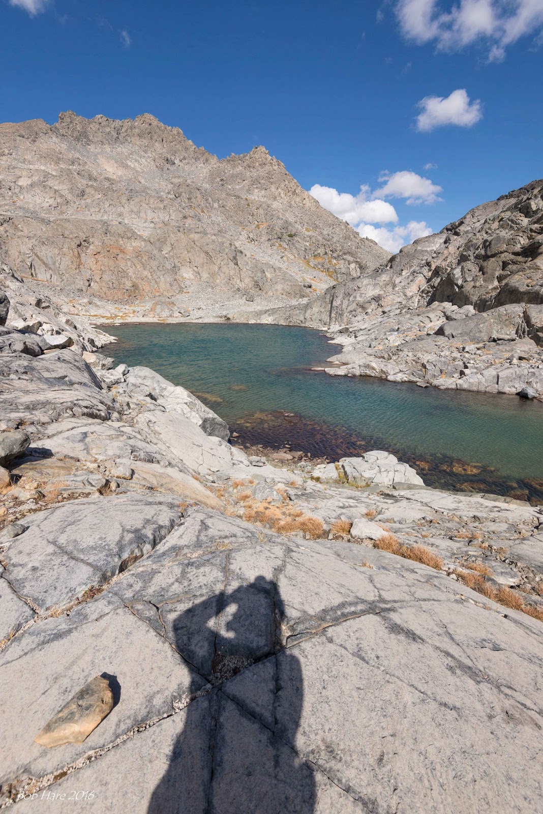
| Here is the outlet of the glacial tarn I climbed around. I was feeling the eerie wildness of remote wilderness. I was glad that David was just an hour away and waiting for me. But being out here alone in this glacially-polished rocky, cold, and windy place gave me a paradoxical feeling of both ecstasy and foreboding. I was certainly feeling fully alive and focused. I climbed a bench to a little pass and found myself looking at Muir's view of "One of the highest Mount Ritter fountains." |
 |
| This is my rephotograph of Muir's 1870s sketch view. The distant Southwest Glacier is nestled under "12,344-foot "Neglected Peak," so named because it was one of the last High Sierra peaks to be climbed (in 1964). The clearly-seen lake is the northernmost of the three "Ritter Lakes." The lowest and middle lake is barely visible beyond while the third lies unseen below the glacier. I had a quick lunch behind some wind-blocking rocks and made photographs whenever the clouds parted and the sun drenched the landscape. Then, I packed up my gear and hurriedly, yet cautiously, retraced my route around the tarn, around Catherine Lake, and up to the pass where I appeared at exactly 3:30 p.m. shouting down to David who reappeared from behind his sheltering rock to wave me down. Together we made our way down the talus and across the meadows to our wind-blown camp still 1,200 feet below. |
 |
| The next morning we had a gorgeous sunrise with the mountains all socked in. We decided to cut our backpack trip short as the weather was turning colder and threatened snow. We had come home to the mountains and then went home. |